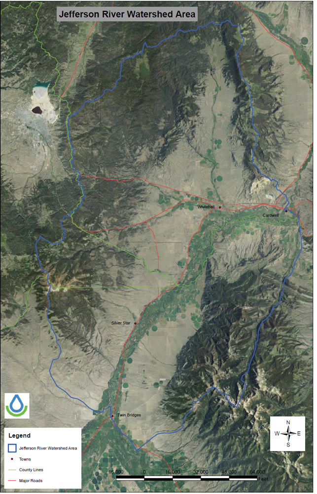
4.28.10
    JRWC Meeting, 7:00-9:00 p.m. Whitehalll Middle School - Council Meeting - Agenda

08.18.10
   Council drafts 2010 Jefferson River Watershed Restoration Plan  Click above for a full copy

9.27.09
    Council develops the Jefferson River Total Maximum Daily Load document.  Click above for a copy.
JRWC is a non-profit organization.  The Council seeks to develop practical solutions to difficult problems that impact the river, which will benefit all interests today and tomorrow.  The main objective of JRWC is to improve the Jefferson River base flows and quality.

Working in unison with state, federal, and various organizations, the Jefferson River Watershed Council strives to achieve better water quality and quantity, while enhancing the areas natural resources and natural wildlife along the Upper Jefferson River area. 

The Jefferson River is located in southwestern Montana and includes drainage from the Highland Mountains to the west, the Bull and Elkhorn Mountains to the north, and the Tobacco Root Mountains to the south and east.  The Ruby, Beaverhead and Big Hole rivers converge to form the Jefferson River just north of the town of Twin Bridges.  The area of interest to the Jefferson River Watershed Council includes the Jefferson River from the headwaters downstream to Cardwell, Montana.  The Boulder River watershed,a major tributary to the Jefferson River is excluded.

Average annual rainfall in the valley is 9.65 inches with May and June being typically the wettest months.  Average annual snowfall is 11 inches with the majority coming from January through March.  However, the Tobacco Root Range exceeds 10,000 feet in elevation and rainfall can be as much as 20 inches and snowfall can be greater than 86 inches depending on the year.

The Jefferson River watershed from the headwaters at Twin Bridges to Cardwell encompasses approximately 469,994 acres.  Landownership is 57% private, 28% Forest Service, and 15% state lands and Bureau of Land Management combined. Rangeland and forested areas are the primary land uses, while agriculture comprises around 15% of the landuse. The majority of agricultural production in the valley is irrigated hayland.
News  and Events
Council's Profile
Hello & Welcome